GREG'S ADVENTURES
2004
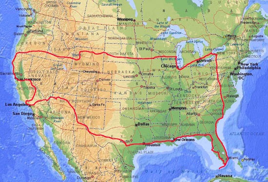
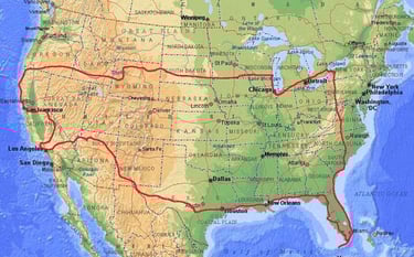
AROUND USA
IDEA AND PREPARATIONS
Following two trips overseas it was time to discover this mighty continent, to see the land with my own eyes and to experience the stories I have heard about the USA from other travelers and from Jacek. We didn’t need to do any special preparations, no visas needed, no airline tickets, no hotel bookings; everything was as usual and completely spontaneous. We would just “go”, making a counterclockwise tour around USA.
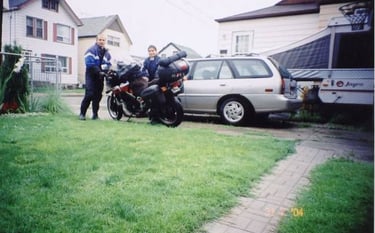
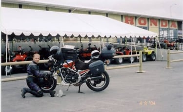
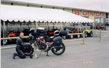
My 1984 Interceptor needed a major overhaul in order to survive the trip. It received new air filter, spark plugs, chain, tires, oil filter and oil. I also greased every possible moving part, checked the wiring, fixed the long seized brake calipers and custom fitted the Kappa side cases with stainless steel brackets. I was advised not to tune up the engine, it is Honda “if it ain’t broke, don’t fix it”.
STATISTICS
July 31 – September 2. 34 days
Countries visited: 1.
Kilometers: 18000
Gasoline: 890 liters, average 4.94 liter per 100kms
Motorbike used: Honda V500 Interceptor 1984
Equipment failures/problems: Rusted fuses failed
Punctures: 0. Arrived home with a nail in a rear tire.
Pictures taken: 298 plus 5 hours of video
Cost: Gasoline: 700 $CAN / Lodging, food, other: 1700 $CAN
DAY BY DAY
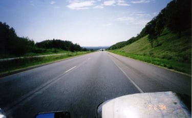
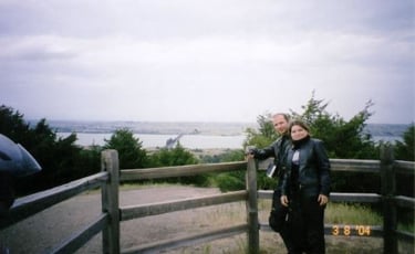
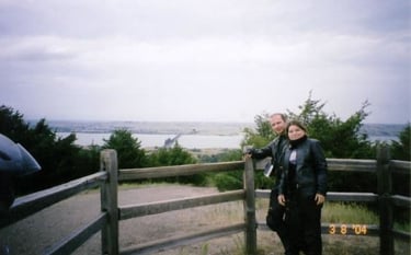
Day 1, July 31 – Hamilton, Ontario to Kenosha, Wisconsin – 978 km
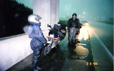
It rained when we left Hamilton. To make the beginning a bit more exciting we did not even make it to the nearest gas station when Honda stopped. No, it wasn’t broken, just no gas. I put the bike on its left side and managed to squeeze last ounce from the tank just to make it to the gas station. About one hour into the trip it stopped raining, great. To avoid congested border crossing in Windsor we headed for Sarnia.
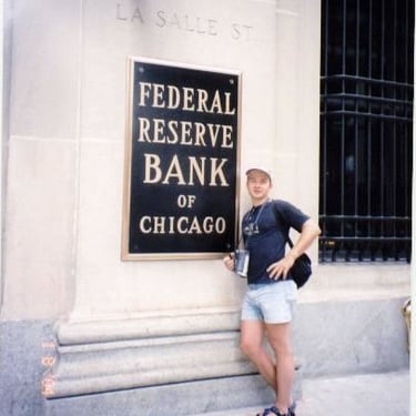
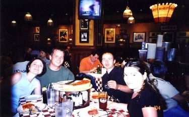
An easy 15 minutes and we were in USA on a bumpy I-69 going west. Not really much to see here, farms, strip malls, fast “garbage” food restaurants. In general this kind of architecture will accompany us most of the time. We got our first glimpse of Chicago before it got dark. Today we would not see the city. Our first night we spent with Natasha’s friend Julia and her husband Matt in their cozy flat.
Day 2, August 1- To Chicago and back by car
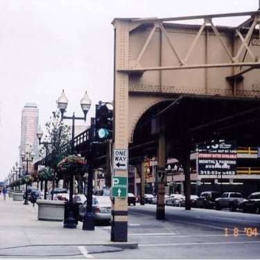
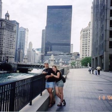
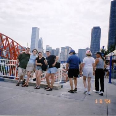
Since it was Sunday Matt and Julia took us to explore Chicago. It is a very nice “all American” city beautifully situated on the shore of Lake Michigan. The skyscrapers are humongous but they are not ugly, they strangely fit into the overall mosaic of new and older buildings. We walked around the harbor front, downtown. We ascended to the top of Sears tower.
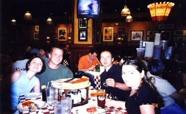
Exhausted and hungry we rapped up the evening in a restaurant consuming a “Chicago style” deep pan pizza. Great day in a great city thanks to Julia and Matt.

Day 3, August 2- Kenosha, WI to Fairmont MN – 705 km
A day of mostly highway riding. First we took road #20 which turned into road #12. A nice, scenic detour took us through small towns with colonial buildings and big mansions.
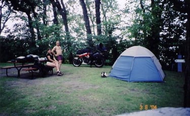
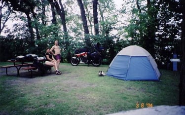
Quick ride on I-39 till we reached I-90 heading west. Today we crossed the mighty Mississippi River which meanders around local mountains, nice views. Now we entered the farmland; flat, green and often affected by thunder storms and tornados. First camping around Fairmont ended up to be a pleasant place with only few RV’s.
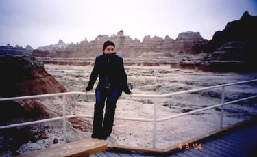
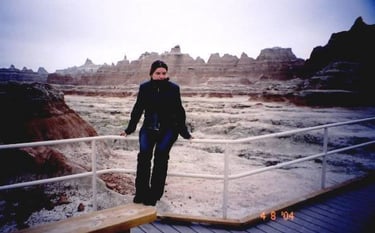
Day 4, August 3- Fairmont, MN to Badlands NP, SD- 620 km
More green farms and heavy clouds started the day. Wondering if to put our rain gear on now or later we pressed on. Two Harley riders took the nearest exit but we did not. Before us there was a huge black cloud. We just made it to the nearest bridge when it started to rain heavily. It was a downpour with very strong winds. An “iron butt” rider on a cross-country ride joined us with his 1500cc Honda Valkyrie.
At minimum visibility everybody was stopping. Later we found out that two trucks and numerous cars were overturned in the storm, At Chamberlain we crossed yet another mighty river, Missouri.
The landscape changed dramatically. No more green farmland, now we could enjoy rolling hills with dry grass and yellowish-red earth, the land of ranchers and cowboys. Our Honda at this time also asked for more attention, the speedometer cable broke. Since there was no reserve indicator and all the distances were posted in miles it was difficult to determine how far to go before refueling. Honestly I was completely confused with all those miles. What is it, something like 1.6km to a mile? Hey fellow Americans, get real and advance to the next century by switching to metric system. Imperial measuring is an ancient and outdated idea and nobody I met in USA was able to answer such basic questions as: how many inches in a yard? How many inches or feet or yards in a mile? Can you answer that?
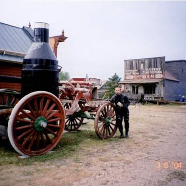
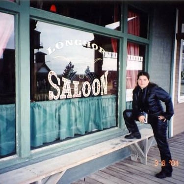
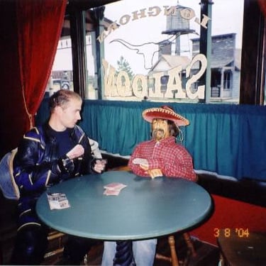
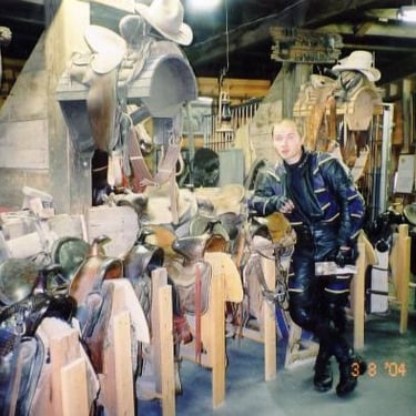
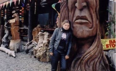
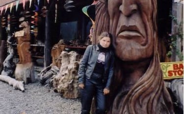
We stopped by highway 63 to experience first hand the lives of western pioneers. South Dakota’s original 1880 Town is a tourist trap but I give it two thumbs up, it is a good one. It has a nice collection of periodic memorabilia: scalps, guns, pictures of gunmen and outlaws, and a long street with either preserved or rebuilt wooden houses. Good introduction to the “WILDE WEST”. We stopped for the night at the camping in Cactus Flats, right before Badlands NP

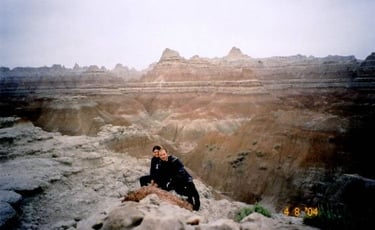
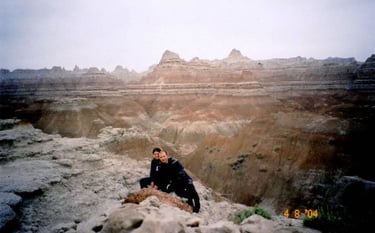
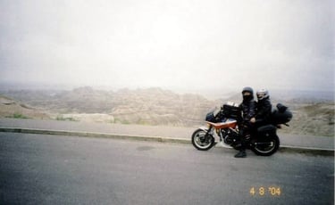
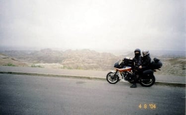
Day 5, August 4- Badlands NP, SD to the rancher’s field by road #111, WY – 415 km
Badlands was the first NP on our way. We decided to purchase the yearly NP pass, big savings. Pretty much it is enough to take the loop road to get the feel of the landscape. The whole idea is “erosion”. The soft red earth is being washed away by elements creating very unique canyons, rock and mountain formations.
In Rapid City I managed to locate a big Honda dealer where the speedometer cable was replaced with a new one. Great, now back to kilometers.
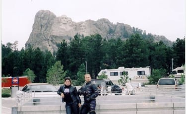
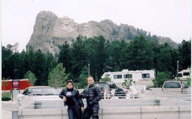
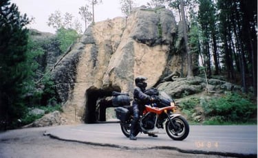
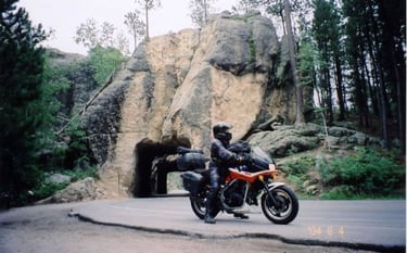
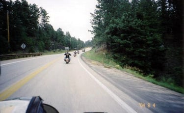
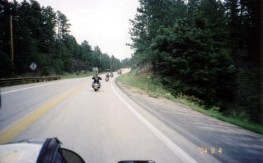
Now to Mount Rushmore to see what is the rush about it. Nice mountain roads create very encouraging riding possibilities. Since the nearby Sturgis motorcycle rally was approaching the area was infected with loud bulky tractors (Harleys). I saw quite a few riders by the side of the road looking for lost screws. Odd and not very practical bikes but the riders seemed to be quite pleasant, yet very proud of their loud “tractors”. We managed somehow to fool the parking attendant and we did not pay the 8$ scam parking fee. If you just walk in it is free of charge. We saw the curved in stone heads and left the site.
I think it is more interesting to see some nature so we took the twisty #16 to Custer SP to hopefully see some buffalo.
Well, first it was donkeys then the big hairy bison.
On the way to Sturgis we dropped by the new tourist attraction, “Crazy Horse”, which is not even finished but they already charge admission. Skipped this one, it was in clouds anyway. On #385 more farmers on their loud “farm vehicles”
and in Deadwood lots of them and their owners already partying. What is interesting, these people call themselves bikers but many of them do not really ride their bikes to Sturgis, THEY TRUCK THEM, shame on you “tough guys”. At Sturgis the preparations for the rally are almost finished. The main street is full of stalls selling all kinds of Harley paraphernalia and the Harley “riders” flock the bars to party. It is certainly an interesting event, just like our Port Dover, but still a week left to go.
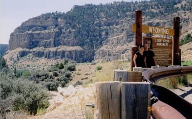
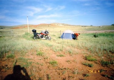
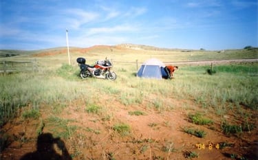
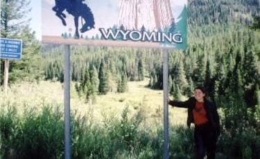
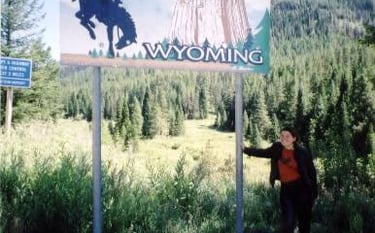
Back to the highway, it was getting dark. We just passed the Wyoming sign when, in the distance, I saw a huge black cloud and lightning. Not to go into it I took the first exit and headed away. In the middle of nowhere there was a lonely house. I asked the rancher if we could camp on his land and he said yes. Awesome, a couple of hundred meters (yards) further I opened the fence and we got in. At night we were woken up by some noises. It ended up being horses that curiously walked around our tent and sniffed us thoroughly. What a night.
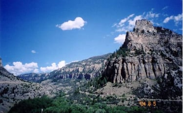
Day 6, August 5- Road #111, WY to Bridge Bay, Yellowstone – 723 km
At six in the morning a screaming woman woke us up-“hey you in the tent make sure you close the fence, I don’t want to loose my horses”. Very protective attitude, surely it was justified. I think she took one horse and left us with two more galloping beauties.

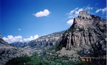
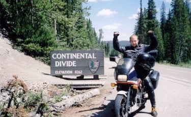
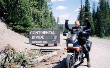
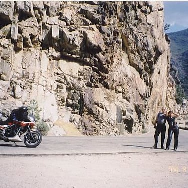
Back on I-90 going west we reached Renchester. Here we ended our throughway odyssey, ahead of us almost 4000m tall Bighorn Mountains. Road #14 started with some road work. I was told that some Harley riders wiped out here on loose gravel. I managed to get through without an incident, yeah. On asphalt the 500cc Interceptor should be fast, well, here in the high mountain my Honda almost gave up on us. At low elevation even with Natasha and 40kgs of luggage I could go easy 160km/h but here at high altitude the story was different. When climbing steep hills we were so slow, even trucks were passing us. The jets in the carburetors would have to be readjusted. Four carbs, too much work, downshift and live with it. However, we were glad to be in the mountains, they provided such relieve from the monotony of riding. Constant turns limited my sightseeing so we stopped a few times to completely absorb the new scenery.
Next range of mountains appeared right after Cody.
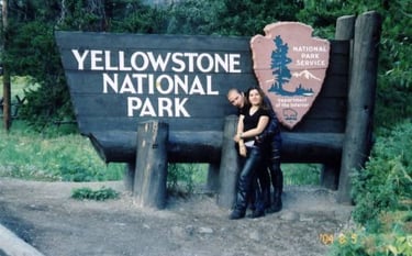
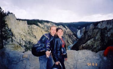
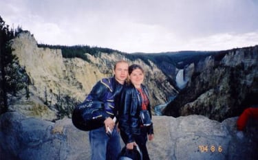
More fun going through Absaroka Range on #14 which took us straight to the Yellowstone entry booths.
There I flashed my pass thus avoiding to pay a steep 20$ entry fee. Also at the entry there is a board with all the campsites and their availability, neat stuff. We headed for Bridge Bay camping situated at 2357 meters, right on Yellowstone Lake.


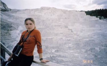
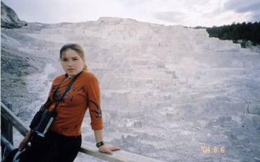
Day 7, August 6- Bridge Bay to Mammoth Hot Springs and back – 220 km
The night was bitterly cold at about 4C. We put everything we had and it was still chilly. However, when the sun came out it became very pleasant. The camping we ended up on was just a field with asphalt roads and designated sites/parking spaces, second most primitive type with basic toilets and sinks, no hot water, all for “just” $18 per site. I guess if you travel in a larger group up to 6 people it becomes worth it.
Hungry like two coyotes we stormed the nearest outfitters store to stock up on provisions. Everything was at greatly inflated prices. On the way to Canyon Village we spotted a huge herd of buffalo. Let’s have a picnic here, I suggested. We occupied a picnic table on the other side of the road where we could safely observe the buffalo, how lovely. Right in the middle of our feast, the herd decided to cross the road. We fled in panic when a number of huge bulls stormed our picnic area. They seemed to be interested in our sheep skin we had as a seat cover. It looked like one bull wanted to copulate with our Honda. If it goes to the food on the table, well, the “hairy guys” licked everything we left but ate only Natasha’s yogurt. Very slowly the herd moved away but single cows continued crossing the road. Some tourists in a pick-up blocked their way for a while to let us gather our things. In a hurry I jumped on my Honda and rode away. What a breakfast.
The rest of the day was very pleasant. We visited Mud Volcano, Artist Point (a colorful canyon),
Roaring Mountain and Natasha’s favorite the Mammoth Hot Springs Terraces.
On the way back we saw some more interesting animals.
Another cold night ahead of us, but this time a guy from Denver helped us make a camp fire
Day 8, August 7- Bridge Bay to Snake River Camping (Teton National Forest) – 270 km
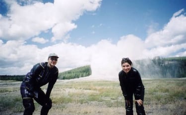
We left Bridge Bay to explore the most visited attraction of the park, the Old Faithful (a geyser that faithfully erupts about every hour). It was dismally unbelievable, not the geyser but the things built around it, a full tourist complex with hotels, restaurants, huge parking lots and a viewing area to glorify the geyser. If it goes to the geyser itself, we waited for an hour and watched people crowding around it. Suddenly it started gashing hot water and gasses into the air before it fully erupted. The pleasure lasted for maybe 5 minutes, and then people disappeared. Oh well, a geyser.
We went to see some more geysers and bubbling sulphur springs until we had enough of smell of broken eggs.
Next on the agenda was to see the Grand Teton Range. Heading south on #89 we found a self-service primitive camping few hundred meters from the highway. You have to take an envelope, deposit a fee and drop it in a box. It is a very efficient idea but who really pays for that, we didn’t. Very primitive yet organized place, with food storage containers (against bears), basic toilet and numbered campsites. Many places in USA are run this way especially in National Forrest. Tonight only two sites were occupied in this secluded place.

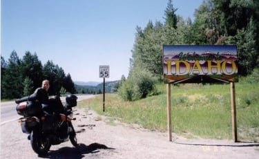
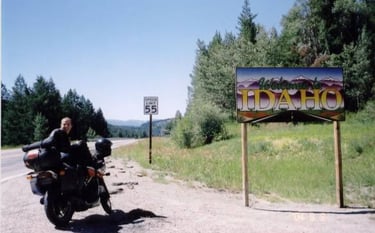
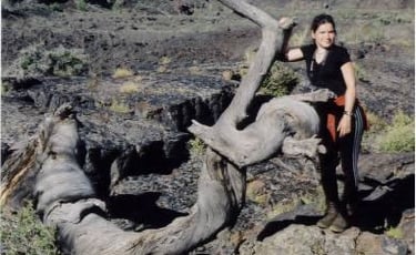
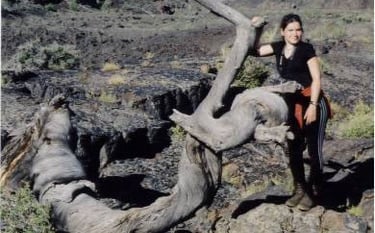
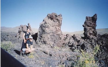
Day 9, August 8- Snake River, WY to Craters of the Moon NM, ID – 419 km
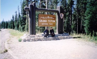
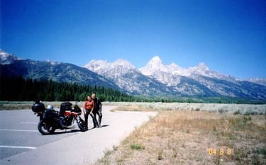
Grand Teton NP is a series of high snow cupped picks. To visit the place would require another day in the mountains and organizing some trekking trip, maybe next time. Otherwise it was a day of riding through Jackson,


,Then #22 to Victor,
#31 to Swan Valley, #26 to Idaho Falls, #20 to Arco and a bit further to see the moonlike landscape of volcanic lava and ash covered land. The first impression: awesome, scary and out of this planet. Here we found a self-service 50% occupied camping (we paid). Volcanic lava rocks all around and the ground, well, it was pretty much black dusty ash. Since it was still day time I had enough time to prepare a meal using my Russian-made, 20 year old stove. Awesome equipment, it works on almost anything especially gasoline. We ate some noodles and enjoyed neighbor’s guitar playing. It was finally warm.
Day 10, August 9- Craters of the Moon NP, ID to Juntura, OR – 552 km
The tourist area of the park is limited to the attractions placed around the loop road. It took us maybe 2 hours to enjoy a variety of rock formations, some spatter cones and tree garden.
We climbed an Inferno cone and headed for the main attraction, the caves just to find out that they were closed due to pathway construction. Bad luck.
With still long day before us we hit the road. The long #20 took us through some deserted hilly area. Nice ride but it got very hot, above 40C. I-84 took us to Boise where I changed oil at the Pennzoil station. The oil boys at Boise even found an oil filter for my Honda at the nearest parts shop.
What amazes me about USA is how easy it is to find parts for a variety of equipment. There is a huge selection of aftermarket parts that are cheaper, widely available and of good quality. Another comment is about Boise, a city on the high plateau with scorching hot weather in the summer and, as we found out, cold and dry winters. There is nothing special about the city, just a typical American town with fast food joints, strip malls, Wall Mart, gas stations, one or two floor houses, you get the picture. I was curious what do people do in Boise, the town in the middle of nowhere and frankly I had no clear answer other than: driving cars, going to cinema, and….hmmm?
We continued on I-84 to Ontario where we turned again to the deserted #20. This area of Oregon was really empty with only a few isolated establishments.
Juntura did not even have a working gas station. What it had was a decent motel/RV park/camping and a family run restaurant.


Day 11, August 10- Juntura, OR to Prospect, Mill Creek Camping, OR – 589 km
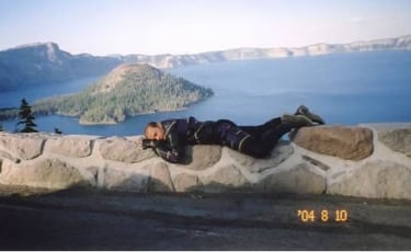
After a warm and peaceful night we were ready to try family type cooked breakfast. The dining room looked rather ordinary with compartments like on a train, a bar along cashier and some regular tables. I had hush browns, eggs and sausages and Natasha opted for a vegetarian omelet. Nice service and rather normal price $15 for two. Relaxed and well fed we continued on #20 to Bend where we finally started going south on #97. Our next point of interest was Crater Lake NP. Flashing my park pass started to become a routine. The ranger gladly swiped it and gave us a map of the area. Everything was so completely organized. When we climbed up to the crater the lake opened up in front with its amazingly blue water. It was breathtaking, but in a way that’s all it was.
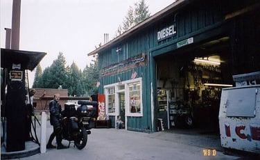
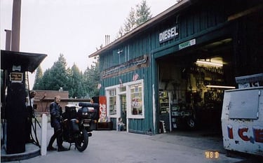
In Prospect on #62 we gassed up at a local gas station/garage ran by a fugitive from California who suggested a campsite.
Tonight, another National Forrest self-service camping in deeply wooded area. We were getting closer to the wet climate of Pacific Ocean.
Day 12, August 11- Prospect, OR to Hales Grove, CA – 658 km
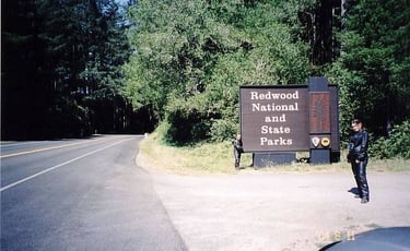
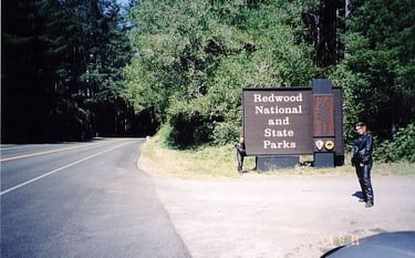
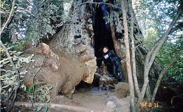
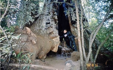
Today was the beginning of the Red Wood/Sequoia days.
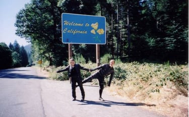
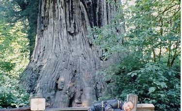
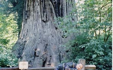
We took #62, #5 to Grand Pass and #199 to Crescent City. Here we observed very interesting weather phenomenon. Half of the town was sunny and warm while the other half, closer to the ocean was foggy and cold. Naturally, when we first got to the ocean we could not see much of it. California welcomed us with sun, just because #101 did not hug the coast. The first impression riding through redwood forest was overwhelming. It felt like we were some super small midgets. We went to see the biggest tree in the area simply called BIG TREE
and then we climbed a very steep hill to the Lady Bird Johnson Grove in Redwood NP. Walking around those huge trees was even more amazing. Huge giants with furry bark were everywhere. Some of them burned inside, some have already fallen. An excellent place to play Pick-a-boo.
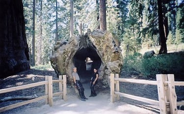
One more attraction for today was a shrine drive through tree. A pure tourist trap but why not. Back on #101 down to Leggett where we met the scenic #1.
The ride was rather difficult with constant twists and 180 turns, if not dangerous. Deep forest amplified the coming of the night. Luckily I spotted a parking lot. It was some company run park project. Tonight we slept right beside two huge redwoods. I felt like it was a fairytale scary place.
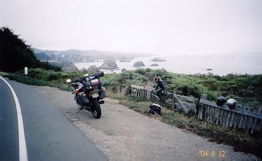
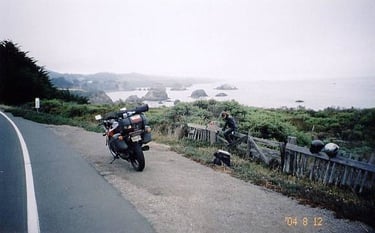
Day 13, August 12- Hales Grove, CA to Castro Valley, CA – 439 km
Even in the morning the heavily forested area looked pretty gloomy. The ocean appeared again around Westport, this time with much less fog.
It took us the whole day riding along twisty and picturesque road #1. It reminded me Turkey’s Mediterranean coast, but here it was much colder. Continuous riding through fog saturated with salt caused our Honda to give up on us. The engine suddenly stopped. The problem: rusty ignition fuse was cleaned and reapplied.
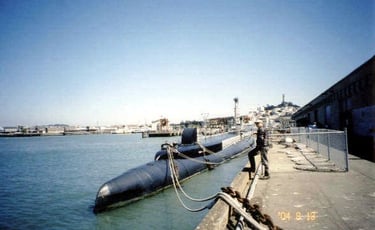
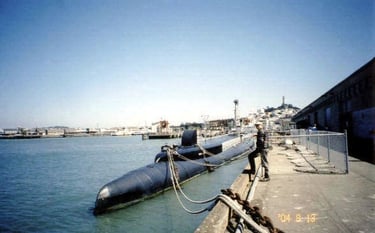
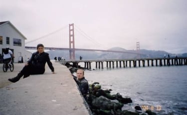
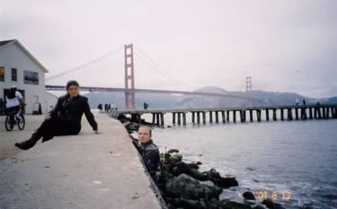
Golden Gate Bridge appeared through the fog but you could still see almost all of it. First impression of San Francisco: clean, organized and friendly. Few more turns and we were on Bay Bridge heading to a warmer camping place across the bay. By staying in Golden Gate NRA, right by the ocean, we would have had another cold night. The ranger at Chabot Regional Park was very nice and gave us her last site reserved for spontaneous travelers like us. It was yet another night spent among somewhat smaller sequoias.


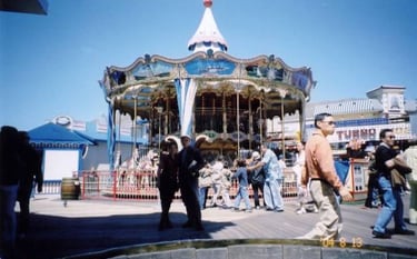
Day 14, August 13- Castro Valley to San Francisco and back – 163 km
We entered the sunny side of San Francisco through Bay Bridge, a very long steel construction. Once on The Embarcadero we headed for Fisherman’s Warf and the Marina District. To find car parking, forget it, but I had no problem squeezing Honda in between vehicles. The pear area is a very busy and touristy place with the usual tourist traps.
Among other attractions we spent some time in a museum of games. Old player pianos, dancing puppets, well-wishing machines and other old noise makers encouraged tourists to loose their quarters. Next, a picture with the orange bridge
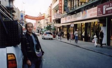
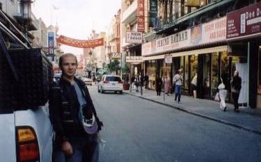
and then we got lost in the famous China Town,
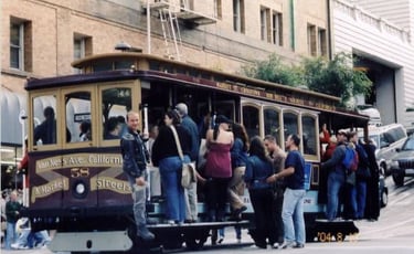
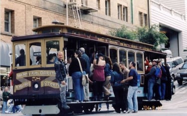
rode a cable car (or hung on it),
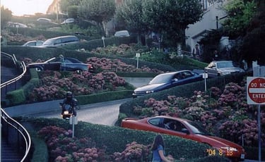
rode down Lombard Street,
got elevated to the top of Coit Tower and finished the day walking around palm treed Union Square Park. Back at the camping we were subjected to the loud noises of Latino party animals. Late at night police came and restored order.


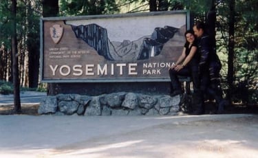
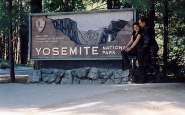
Day 15, August 14- Castro Valley to Fish Camp (by Yosemite NP) - 369
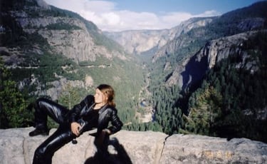
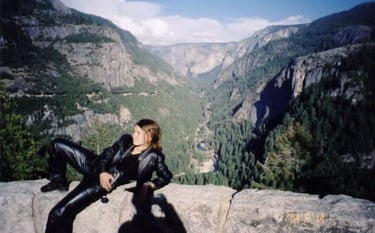
Yosemite NP is said to be the most beautiful park in the whole USA. To get there we took #580 and #205 to Manteca and then #120 climbed up to the park’s gate.
The mountains are stunningly picturesque and all one needs to do is look around and absorb the views. We were not interested in hiking here so we rode around on all those blind-cornered twisties till we absorbed it all.
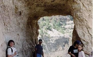
At the southern end of the park we walked around Mariposa Grove, a hiking area with huge sequoias, and got awe inspired by more trees.
We left the park at nightfall and sneaked in a nearby camping with “no vacancies” sign. There was still lots of space but of course this is USA, everything is organized, you have to park your vehicle in a designated place. We found one unoccupied bay though there was a ticked “reserved” on a post. 9pm, who is going to show up here at night? We pitched our tent and went to sleep. At about midnight the campground volunteer/attendant woke us up with his loud and unpleasant tone and started threatening with police. The people who reserved the spot showed up late and complained to the attendant, though they had more than enough parking space and probably half an acre to set up their tents. I tried to speak to these people but they definitely wanted us out. For $20 I managed to make the attendant come down and understand the situation. He let us stay on the premises but at a different place by ranger’s parking spot. We had to drag all the gear a couple of hundred meters to set it up again. We carried a dome tent without dismantling it and I quietly rolled the bike. It was definitely not a pleasant situation, it just proved the inflexibility and lack of common sense among some people.
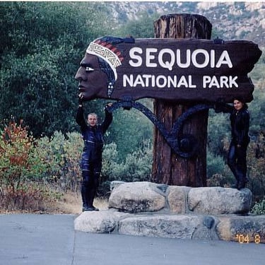
Day 16, August 15- Fish Camp to Three Rivers (by Sequoia NP) - 473
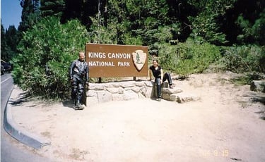
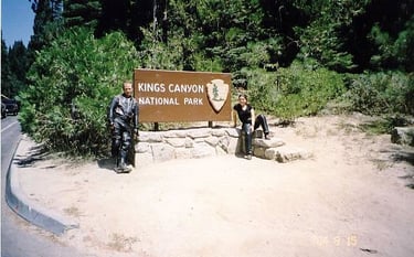
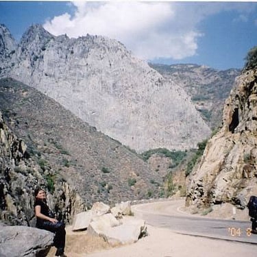
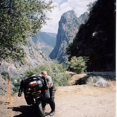
We left the campground, simple toilet and one running water tap, before sunrise. Few kilometers more of a steep descent and we were back on flat. In Fresno we turned to #180 which started climbing again up to the Kings Canyon NP. You can’t farm in the high mountains or develop any industry which would damage the ecosystem so the governments invented National Parks. Great idea, at least people can come to enjoy the scenery. The only difference is that in USA you often have to pay high prices for this enjoyment, it is their industry. The park had even more stunning views that Yosemite.
We took the twisty mountain road #180 down to the canyon and returned the same way.
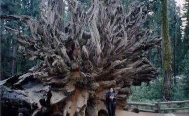
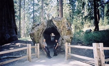
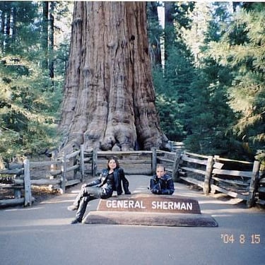
Sequoia NP was the last big tree experience for us. Here we admired some more standing and fallen giants.
Still enjoying daytime we started a long descent on yet another super twisty road with blind corner every 50 meters. It was scary at times. Once we were down in the valley we found a regional park camping by Lake Kaweah, a rather deserted place

Day 17, August 16- Three Rivers to Leo Carrillo State Beach (by Malibu) – 476 km
The original plan was to go to Death Valley NP but when we stopped for breakfast at one of the gas stations we learned that there was a flash flood in the park and it was closed to the public. Thanks to a helpful local man we avoided an unnecessary trip. Instead we headed for Los Angeles, the biggest metropolis in California.
From #5 we turned on #126 to Oxnard. Right on the Pacific coast there are several beach parks with camping facilities. We were again very lucky. The ranger of the state beach gave us her last site, right on the beach, well everybody camped on the beach, it was a beach camping. Before hitting the sack we rode to Malibu and stocked up on provisions. We had a wonderful supper on the beach with the accompaniment of waves and greedy seagulls.
Day 18, August 17- Leo Carrillo SB to Los Angeles and back – 246 km
In the morning we found out again how lucky we were. At night the ocean was at high tide and with big waves some tents got flooded. However, right before our tent the previous occupants dug a trench which absorbed the water thus saving us from being flooded.
Malibu is famous for its beaches and crazy surfers. On the way to LA we checked out such a beach. Hundreds of surfers in wet suits floated in cold Pacific waters with deep fog above them waiting for the right wave. In a way it must be fun when a big wave comes.
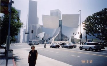
Our first impression of LA was negative: visible poverty, dirt and homelessness. We rode around several districts and wished to get out of there. The downtown has some interesting modern constructions and some tall buildings.
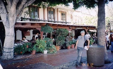
The most interesting part was the alleged historical center of the founder of LA, a street with few older brick buildings and the founder’s house. The whole area is designed for tourists with stalls of souvenirs and few stylish Mexican restaurants.
On the main square we watched two Indians dressed in costumes perform a ritual dance. It was interesting though it seemed like one dancer did not have much sense of rhythm.
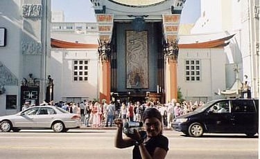
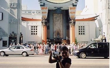
It was enough of dirty LA, we headed for Hollywood hoping for a better experience. Indeed, Hollywood seemed at once cleaner and definitely more tourist friendly.
We walked along Hollywood Boulevard trying to read the names on the walk of fame. It is supposed to be the heart of the movie industry but apparently there is only one producer left in Hollywood.
Next we moved from the street of fancy cinemas to the street of trendy fashion stores. Santa Monica Boulevard was supposed to impress me with its charismatic style. What I saw was a street with lined palm trees and, as in most of US places, rows of spontaneous structures which did not really fit one to another. I thing there must be some depth to the style of LA and its surroundings but to better understand it one would have to stay there for a while and experience it.
Back at the beach camping we enjoyed the evening by the fire and listened to the waves. I think we liked it more than busy and dirty LA.
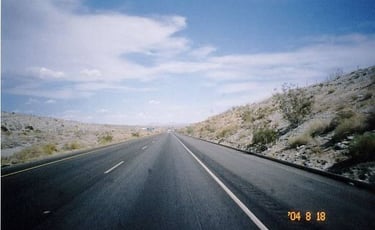
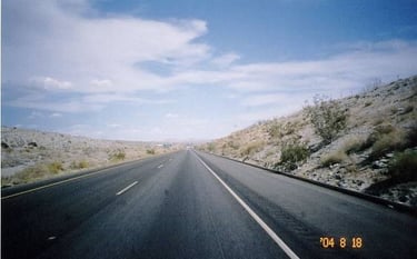
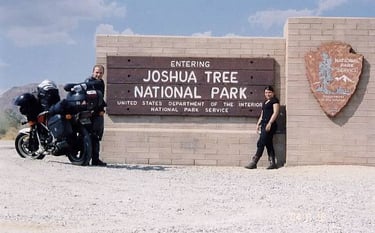
Day 19, August 18- Leo Carrillo SB to Joshua Tree NP – 530 km
Today we left foggy Pacific coast for good. On #10 we had another incident with Honda. Seemingly the same electrical problem, however, cleaning the fuse did not help. In the process of replacing fuses I shorted other connections, it seemed like I burned all connectors. Well, not really, remember it is Honda and the manufacturers predicted any situation. Indeed, right by the battery there was the mane fuse. Right beside the burned unit there was an original spare, probably never used in 20 years. We were mobile again in 10 minutes.
Off #10, Cottonwood Springs Road took us to the park entrance. With 40C in the shade the place was completely deserted except the ranger who stayed in an air-conditioned welcome center.
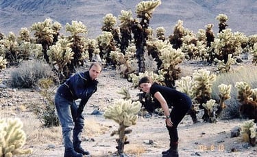
The feature of the park is its famous tree but there are also other natural attractions such as rare cactus gardens and unique rock formations.
That night we stayed at yet another self service camping (didn’t pay for it) among strangely looking boulders.


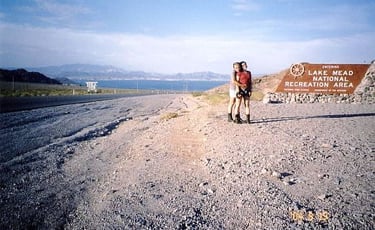
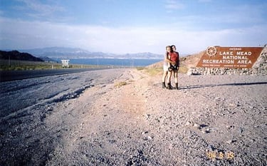
Day 20, August 19- Joshua Tree NP, CA to Las Vegas Bay (on Lake Mead), NV– 468km
We woke up to the screams of a crow standing on the top of a boulder. As in every self-service camping it is better to leave at daybreak before the ranger does his first check. In Twentynine Palms we turned to Amboy Road
then National Trails Hwy and Kelbaker Road which took us through Mojave National Preserve. We saw some large sand dunes on the horizon but could not approach them; our Honda would never make it on the sandy country road.
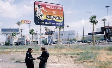
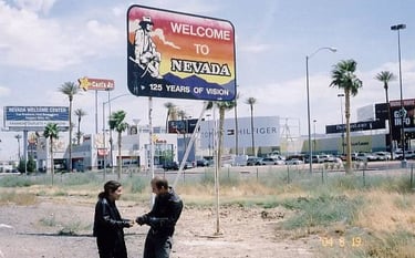
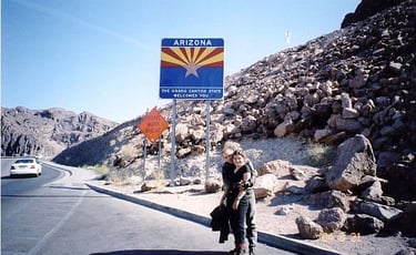
In Kelso we turned to Cima and then further to I-15. Right after we entered Nevada we noticed a big change.
In Primm, an establishment on I-15, they built a whole complex of casino/hotels. The feel is there, the vibe is in the air, the word is “gambling”.
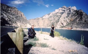
Looking down from Boulder City on #93 towards Lake Mead shows only a part of the reservoir which provides water for parts of California and of course Las Vegas.
The entry to the National RA on Lake Mead was paid but our pass got us in for free. Summer time is not a very popular camping season in Nevada. Excruciating heat makes all the comfort oriented tourists hide in air-conditioned hotels. When we arrived to one of the campgrounds only one site was occupied.
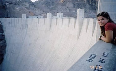
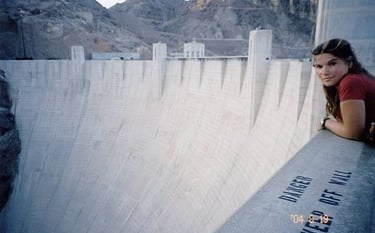
With still a long day to go we decided to visit Boulder City, the town which was built to accommodate the men who worked on Hoover Dam. Since there was really nothing to see there we left the town, after we ate a delicious pizza at Pizza Hut.
The approach to Hoover Dam was quite spectacular. The twisty road made it feel like the dam would never appear. They are in the process of building a bridge so trucks could get across the river. For now only cars and busses are allowed on the dam and only after going through a double security check.
The builders certainly chose a great location for the dam, a bottleneck. The construction is impressive but I think I expected a more massive structure. Perhaps in the movies the perception is exaggerated.
Day 21, August 20- Las Vegas Bay to Las Vegas and back – 95 km
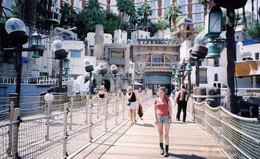
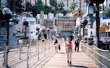
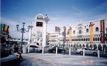
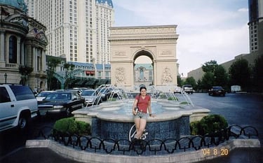
A very hot day, 45C. With a lot of excitement we dressed up lightly and headed for “The Meadows”, the city of kitsch and entertainment. We spent the whole day walking along the Las Vegas Boulevard, “the strip”, absorbing the atmosphere, comparing the architecture to its real counterparts and getting entertained by slot machines and roulette.
I bet a dollar on one number and I won, yeah!! 35$. In the evening we watched the famous water fountain ballet in front of Bellagio hotel, it was impressive.
In general it is a nice place. Though a lot of the architecture is a copy of other famous structures, it looks solid and at times even impressive.
On the way back to the camping we were caught in a rain storm. We got a bit wet but it did not really matter, it was still very hot.


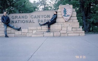
Day 22, August 21- Las Vegas Bay, NV to Grand Canyon Village, AZ – 496 km
One more look at the lake, a ride across Hoover Dam and we were on #93.
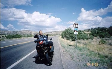
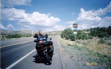
In Kingman I turned onto the famous Route 66 but there was not much there except the sign.
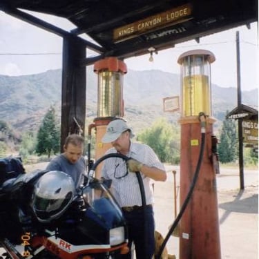
Well, at least we avoided the busy I-40 for a while. In Williams I decided to change oil again. In town the legacy of the #66 was more preserved. Main Street was littered with all kinds of places called Route 66. I stopped at one of the garages where some geezers and two women were being social drinking beer. The guys were happy to help us and provided exceptional service. Don’t get me wrong, they did not change the oil. The mechanic ordered my favorite oil, Castrol, and produced the right oil filter after he cross-referenced it in his catalog. Unbelievable, he even offered us some American 3% beer. Thanks guys.
#64 merged with #180 which took us to our destination. At the gates I flashed the pass; it was becoming fun doing it. By this time we probably saved a 100$.
At the Mother Campground I did not even manage to get to the ranger booth when a couple from Quebec offered us to share their site. Nice people, thanks to them we saved a couple of green. When we talked we found out that earlier this year they met our motorcycling friends in Alaska. What a small world.
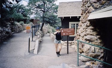
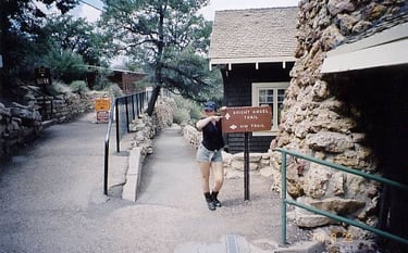
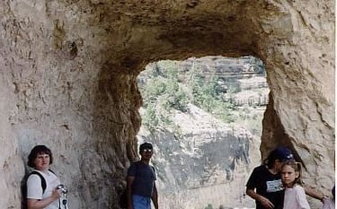
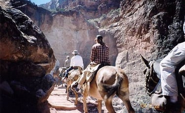
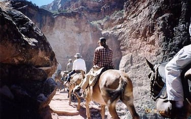
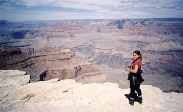
Day 23, August 22- Grand Canyon
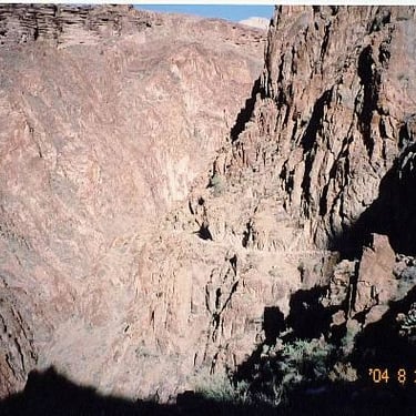
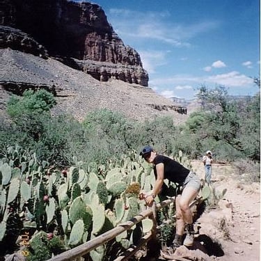
As with all the day trips we made so far we left our gear at the camping. There is really no need to worry, tourists are rather honest people and we never had anything stolen. Today, time to explore Grand Canyon. We had a good breakfast, prepared some food for the road, took a water bottle and headed for the Bright Angel Trail.
We did not really have a plan how far down we would go, it was up to our strength.
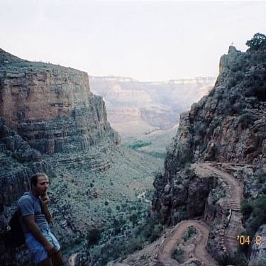
First two hours was a steep descent.
There’s no need to take a lot of water because every 2-3 miles there is a rest station with drinking water. The lower we went the hotter it became. At times we even ran and jumped to gain some ground. Once we got to the Indian Garden we decided to go further.
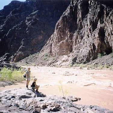
The trail now became flatter slowly descending down to the river. Finally, after 2 more hours we reached the very bottom of the canyon. Spectacular feeling and supreme views all the way down. Colorado River looked like a flow of mud but I guess it is normal. The mountains are full of silt and the river picks it all up.
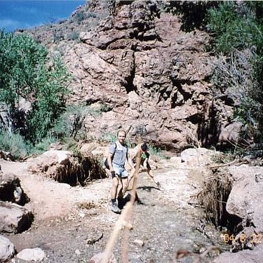
We ate our limited provisions and with still a lot of strength started climbing.
I guess this jumping took a toll on my knees and now I started having excruciating pain. Descending is always harder on the joints. In a lot of agony and with many rest stops I made it to the top. On the way up we passed two other couples, I guess we weren’t that slow. Last hour we walked in the dark and Natasha was very scared of snakes. Amazingly she made the round trip without any serious complains and pain, she would feel it the next day. We were so lucky, it seemed like the last shuttle bus was waiting just for us.

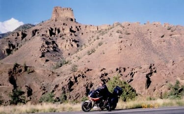
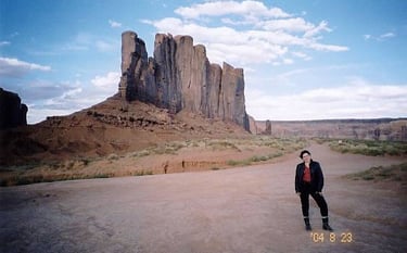
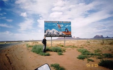
Day 24, August 23- Grand Canyon, AZ to Mexican Hat, UT – 387 km
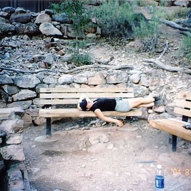
It was an agonizing morning, two exhausted bodies with all the muscles aching, and no one wanted to get up. I wanted to walk it off and headed for the general store. It was a big mistake, it took me one hour to walk ½ a mile, well…it looked more like very slow limping.
We ended our Grand Canyon visit with a ride along the rim road and a few pictures taken from Desert View observation point. I think we both liked the place, maybe one day we come again to hike a different trail.
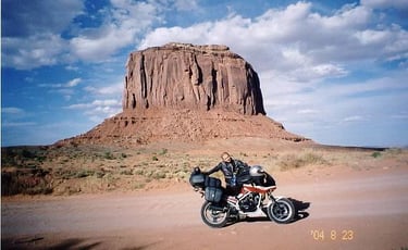
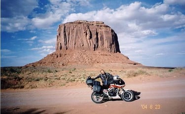
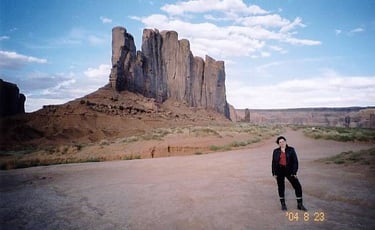
Today we took #64 to Cameron, a part of #89 north, #160 to Kayenta and #163 to Monument Valley Navajo Tribal Park.
Since the park is on a territory of Navajo Indian land it is not associated with any US National Park. We took a self guided drive through dirt road tour around some intriguing rock formations with even more intriguing names. The place is famous for its free standing mysterious rocks and was pictured in many western movies. What a pity the drive through did not take us around the most interesting rocks.
The night we spent for free in a small private RV Park.
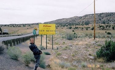
Day 25, August 24- Mexican Hat, UT to Alamogordo, NM – 928 km
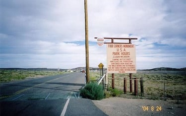
We started around 6am still feeling the effects of hiking. #163 took us to Montezuma Creek, #262 and #41 to #160 where we rode through Four Corners Monument, another Navajo Park where four states meet.
We stopped at a Trading Post in Teec Nos Pos (“small town” in Navajo). In this all Indian establishment first time in my life I heard someone speak Navajo Language. It was exhilarating to hear a woman speak Navajo on the phone or a man communicate in the store. I even asked the clerk about their people but she only answered “well, we are still here”. The Navajo Indians are the largest existing group of indigenes people on this continent with their own ruling organization, laws and police. Natasha was sitting in front of the Post munching on some cookies while almost every Indian man walking by would take of his hat and say hi to her. Was she being mistaken for a local girl?
In Shiprock we turned to #491, then I-40, bypassed Albuquerque on #6 to I-25. In Socorro, when we ate our BBQ chicken, we talked to some locals who told us quite a lot about this area. This part of New Mexico is full of weapons factories. This means if USA was not involved in any wars most of the people of this area would be unemployed.
#380 took us close to the so called “ground zero” where USA tested its first nuclear bomb. We got a bit soaked riding in the warm rain but by the evening we were all dry. Tonight’s sleeping quarters: big RV Park.


Day 26, August 25- Alamogordo, NM to Ozona, TX – 792 km
In the morning we saw the size of the park. It was a place where people lived permanently in their stationary trailers, sort of like small cottages. Plus there was a place for drive through RVs and small patch of land for tents. We missed that part and camped on the concrete pavement among RVs.
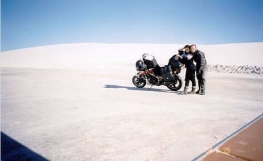
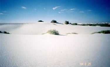
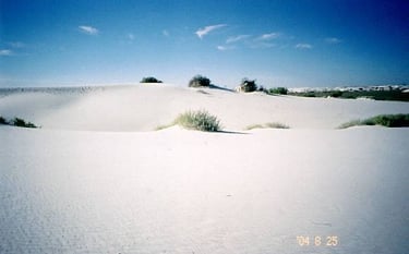
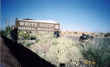
Today’s attraction was the White Sands NM which is found in the middle of the White Sands Missile Testing Grounds on #70. In town we were told that we were lucky to see the park today. Quite often #70 is closed to traffic for hours at a time due to missile testing.
If you have never seen white sand, this is the place to go. The whiteness of sand was spectacular. Though I saw such sand in Poland on the Baltic Sea beach, I was completely taken by this phenomenon. When the tarmac ends the road is made of hard pack sand. It seemed like riding on ice or on a winter road. The usual feeling of being in the desert is emptiness. Here, however, you can see small mountains on the horizon and the feeling of being in the middle of nowhere is far from realistic.
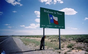
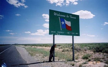
From Alamogrdo we took #82 to Artesia. The small mountains reminded me so much of Poland and its own Bieszczady Mo untains, it seemed like the life just stopped there or at least it moved very slowly. Now on #285 we entered the vast farm and ranch land of Texas.
I think I liked all the side roads we took, there were hardly any cars on them and we could truly enjoy the green of the hilly pastures. In Fort Stockton we were back on a busy highway. I-10 would take us straight to New Orleans
Day 27, August 26- Ozona, TX to Winnie, TX – 836 km
A night spent at another nicely organized RV Park; we were the only tent there.
The rest of the day was just riding on I-10 through San Antonio and Houston.
In the evening we could already feel the effects of a different, more humid climate. At the camping in Winnie the owner told us that this was a slow season and usually it picks up in the winter when snow birds come from the north and Canada.

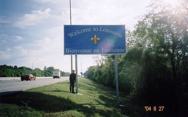
Day 28, August 27- Winnie, TX to New Orleans, LA – 518 km
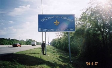
Entering Louisiana was like transferring to a different world.
Since it is in the Mississippi delta, the swamps were everywhere and the highway was built on poles for miles. There were also many more black people speaking English but with some strange accent. Louisiana was a French colony which was later sold to USA. We made the 500kms in less than 5 hours and by the early afternoon we were cruising on the New Orleans streets.
I couldn’t believe hotels could be that dirty but here it was, and for “only” 50$. At least the room was decent.
Most of the city looks of course just like all the other American places. However, Since New Orleans was founded by the French it still has a large Acadian quarter which is now called rather “Cajun”, maybe by the Spanish.
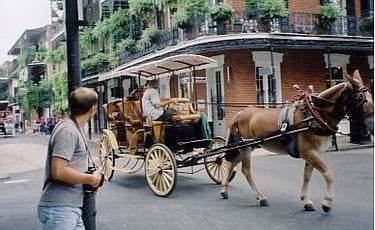
Thus we headed for the French Quarter and the famous Bourbon Street.
Despite the hot weather and being out of season there were still lots of tourists. The whole area is quite unique with its French/Spanish colonial architecture and very relaxed atmosphere. Bourbon Street is full of bars where a variety of live music is played. We were successful to record some of the music, however in some places they just blocked the camera and forbid to immortalize the performers. Beside the entertainment part the French Quarter has also very interesting stores with souvenirs and other items. We saw pieces of a very unique form of sculpture on music theme.
Great place, definitely worth visiting for whatever reason, be it party or other.
Day 29, August 28- New Orleans, LA to St. Petersburg, FL – 1201km
It wasn’t the longest day of riding but for sure today we covered the biggest distance. Earlier I contacted my friends George and Denise who live in St. Pete FL, so we were expected to arrive in the evening. We followed I-10 to I-75 and I-275 to the city. It would have been an easy and uneventful ride if we weren’t caught in the rain. Well, it wasn’t really rain; it was rather a heavy rain storm with strong winds and lightning. Somewhere on I-75 I spotted a huge black cloud ahead. Instead of turning to a rest area and waiting it out I decided to ride through it. Once we were in the storm the downpour was super heavy, visibility maybe 100 meters and every couple hundred meters a car accident. Some cars pulled over, other slowly continued and we behind them. Suddenly lightning struck a nearby pole and at the same time I felt an electric shock, nothing strong to knock me down but certainly it wasn’t pleasant, it was scary. Such storms are common in Florida in the summer but they are localized and pass by quickly. In half an hour we were out of the storm and back in the sun, of course completely soaked.
When we arrived to George’s place (a very nice house with red clay Spanish shingles and a swimming pool) he proclaimed us being “nuts”. OK, maybe we are adventurous but not completely insane. We rapped up the evening in a restaurant munching on some food and catching up with news and stories.
Day 30, August 29- In St. Petersburg
Thanks to George and his membership at the local sailing club we enjoyed sailing (my second love) in Tampa Bay. It was great to be back on the water considering I have not been on a small boat since I sold my little dinghy. Today we just enjoyed being sailed by George, the master and Denise, the cute skipper. Thanks guys.
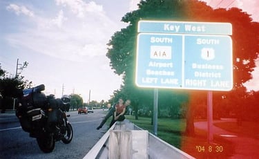
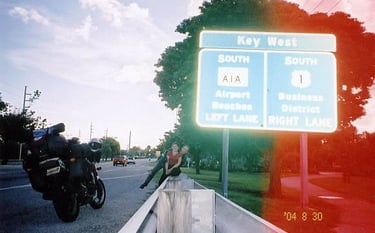
Day 31, August 30- St. Petersburg, FL to Key West and back to Bahia Honda SP –770km
We thanked George for his hospitality and said good bye. Purely out of curiosity we decided to go to the Florida Keys. I-275 through the bridge and back on I-75. In Naples we took #41 short-cut through Everglades NP. We didn’t see any alligators but there are lots of boat tours into the swamps. I think we were already a bit tired of traveling and decided not to see the swamps. #997 took us to Homestead where we joined #1. The Keys are a chain of islands connected with highway on stilts. In general it is a very nice area with water all around and many cottages on land. I just think we expected somewhat longer bridges.
We rode around Key West, did some shopping and left before sunset. At the entrance to the State Park the gates were locked. Fortunately a late arriving camper who knew the lock combination let us in. It was already dark.
Day 32, August 31- Bahia Honda SP to St. Augustine (Anastasia SRA) – 804 km
It is an amazing experience to wakeup before the sunrise. By 7am we were at the gate ready to leave but of course it was locked. The park ranger just arrived so I asked her to open the gate. She immediately started asking questions about our registration. I made up some story that we camped with friends and I didn’t remember the lock combination. She refused to open and told me to go back and ask my friends for the number. I understand she was just doing her job; still she could be less official and let us go. We went back to the campsite where I asked someone for the number. At the gate the ranger did not even care about us leaving as long as everything was by the book. What a strange philosophy, cold and impersonal.
In Miami I decided to change oil again. I think we checked four oil changing garages and none had a small oil pan. They all drain car oil straight to a huge bin. I also went to a motorcycle store with a complete certainty they would help us. It was a huge disappointment. The clerk told me they won’t let me change oil here but they can do it for me for 80$. What a shame guys, you couldn’t even help travelers. We were forced to buy an oil pan. At last I approached yet another garage. A Spanish only speaking mechanic amazingly produced an oil pan and let me do my job without questions. Muchas gracias hombre.
The rest of the day was just riding on I-95.
Day 33, September 1- St. Augustine, FL to Pipestem, WV – 1102 km
Our last night in tropical Florida we spent at yet another State Park with combination lock gate opening idea. Fortunately this time there was a small opening by the gate so we left without any hassle.
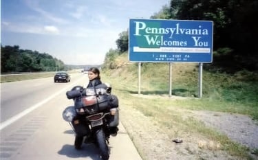
Day of riding on I-95, I-26, I-77. In Virginia we enjoyed some beautiful scenery. The picturesque Appalachian Mountains seemed very inviting.
We took #20 towards Pipestem State Park hoping to find suitable accommodation. When we approached some locals to ask for direction Natasha suggested if we could stay on their land. Surprisingly they didn’t refuse. On the contrary, the man was very friendly. He invited me to his garage where he showed me his hunting trophies: deer heads, huge antlers and bear skin with head. He was also very proud of his Yamaha ATV. Great people, and they lived in such a beautiful place.
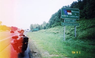
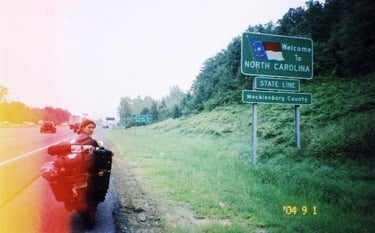
Day 34, September 2- Pipestem, WV to Hamilton, Ontario – 975 km
The man left very early to work but I managed to thank him and say good bye.
We continued on twisty #20 to Rainelle, then #60 and #19 to I-79.
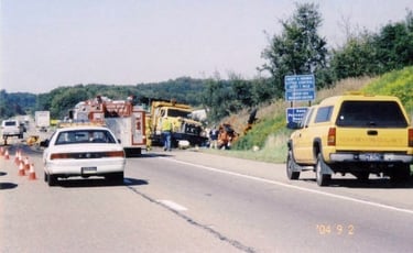
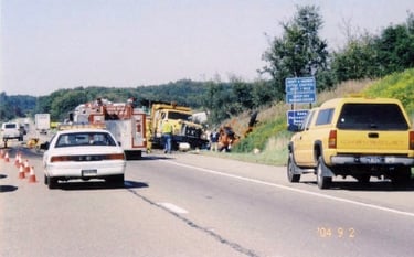
In Pennsylvania, still in the mountains, we witnessed a terrible accident. A truck struck road workers’ equipment and created huge chaos. The highway was backed up for miles.
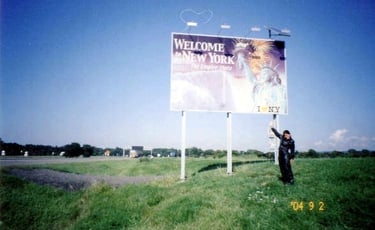
In Erie we jumped on I-90 and when we entered state of NY, to avoid notorious traffic we took the scenic #5.
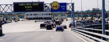
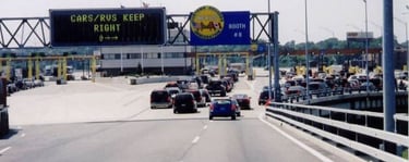
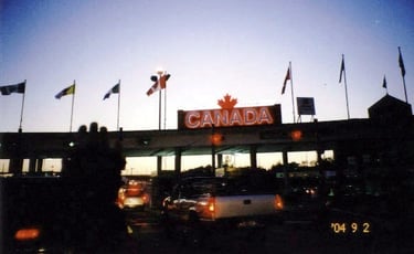
Canadian border crossing and riding on QEW was a breeze.
What a great feeling we completed yet another trip and for sure unraveled a lot of mysteries.
USA is a big and beautiful country and for sure we have not seen everything.
I hope one day we’ll explore the eastern, more historic part.
The tour base is developed to suit any kind of traveler; however, accommodation is often overprized, especially camping. Since USA does not have much history the government tries to attract tourists with country’s natural beauty sometimes to the exaggerated extent. Thus any kind of rarity and natural phenomenon is preserved, turned into a park and often an inflated entry fee is charged. Also the rarity of certain places may be overrated. The most interesting attractions are often overcrowded and the pleasure of exploring them may turn into an unnecessary misery. Despite the visible commercialism it was worth the time to ride through and explore this huge country. Would we do it again? We are not sure.


July 31 – September 2. 34 days
Countries visited: 1.
Kilometers: 18000
Gasoline: 890 liters, average 4.94 liter per 100kms
Motorbike used: Honda V500 Interceptor 1984
Equipment failures/problems:
Rusted fuses failed
Punctures: 0. Arrived home with a nail in a rear tire.
Pictures taken: 298 plus 5 hours of video
Cost:
Gasoline: 700 $CAN
Lodging, food, other: 1700 $CAN